Picture Perfect Spring (and Summer) Road Trips - Part 2
Welcome back to part two of our exciting journey discovering spring road trips around Central Missouri. Today, we're set to delve even deeper into the picturesque landscapes that define Pulaski County. With rolling hills, lush valleys, and breathtaking scenic drives, this area holds a charm that begs to be explored. The excerpts below are taken directly from https://visitpulaskicounty.org/ozarks-leaf-peepers-backroad-bonanza-2/. We encourage you to check out their site for even more details on attractions and activities in Pulaski County. So, buckle up and join us as we set off on the next leg of our road trip adventure!

Hartford Road
1.15 miles northeast of Road Ranger, Highway 28
Hartford Road, a 3.39-mile-long loop drops into a Big Piney River valley. After only a mile you will be rewarded with dramatic river bluffs. In an especially picturesque scene, the road squeezes between the Big Piney River and the former Possum Lodge resort before climbing back to Highway 28 positioned on the ridge above.
Camp/Crown Roads
4.92 miles northeast of Road Ranger, Highway 28
Camp Road and Crown Road partner to lazily loop (5.81 miles) around the former Gasconade Hills Conservation Area. The structures and foundations that perch over the Gasconade River at the beginning of Camp Road are remnants of Brown’s Camp. At 3.05 miles turn right onto Crown Road to return to Highway 28.
Cardinal/Creek/Cave Roads
7.62 miles northeast of Road Ranger, Highway 28
Cardinal, Creek, and Cave roads combine to lead you 3.65 miles to Riddle Bridge Access. At the intersection of Cardinal Road and Cemetery Lane you will find a photogenic country cemetery and church.
Approximately 1.58 miles turn left onto Creek Road. Creek Road parallels, and crosses, Jones Creek before becoming Cave Road which bends to cross the Gasconade River at Riddle Bridge Access. The current bridge, constructed circa 1987, replaced the former 70+ year old structure that was featured on a 1975 Brewer & Shipley album cover. Yellow Bluff, directly across the Gasconade River from the public access is a popular photography scene. Leaving Riddle Bridge Access turn right onto Holtsman Road which becomes Y Highway.

Laramie/Lexington Roads
4.13 miles south of Riddle Bridge, Y Highway
Laramie Road leads to (1.17 miles, turn right) Lexington Road which curls around an area known to old-timers and locals as Shockley Bottom. At 4.49 miles look right and visually follow the power line buoys that edge the field. These lines lead to the former Skaggs Bridge crossing of the Gasconade River of the old Waynesville-Crocker Road. This stretch of Lexington Road is home to two Missouri Century Farms. At the junction of Lexington Road and Highway 17 is Pike’s Peak bluff and the mouth of Roubidoux Cave at the confluence of the Roubidoux and Gasconade rivers.
Tip: Roubidoux Cave is NOT open to the public. Contact Roubidoux Grotto for access permits.

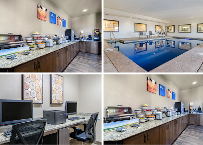
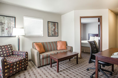
Comfortable Accommodations and Hospitality to Complete the Experience
As we conclude this scenic road trip through the heart of Missouri, we hope you have enjoyed the exquisite views and local attractions as much as we have. When your day of exploration draws to an end, there's nothing like returning to a comfortable home away from home. Look no further than Fort Wood Hotels, the paramount choice for travelers seeking affordable and quality lodging in the Fort Leonard Wood area. Whether you're in town for a day, a week, or a month, we’ve got your accommodation needs covered. Enjoy the warm hospitality and top-rated comfort that has defined our service since 1999. So, until we embark on our next adventure together, we wish you safe and memorable travels!

Comments
Post a Comment